
Recreational & Residential Land for Sale in Coulterville, California
Boneyard Creek Rd, Coulterville, CA 95311
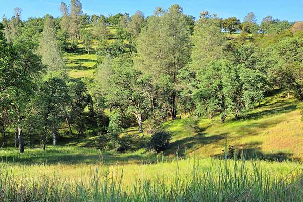
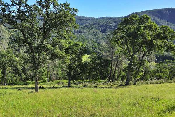
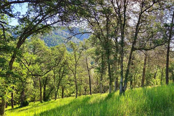
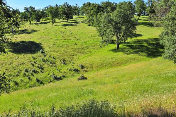
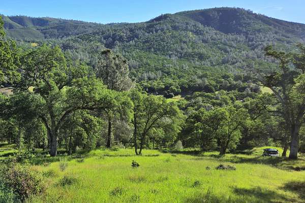
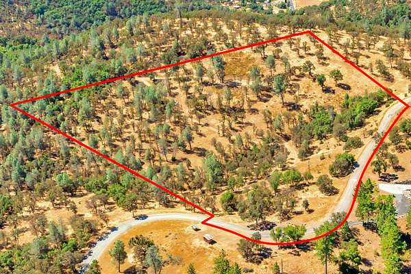
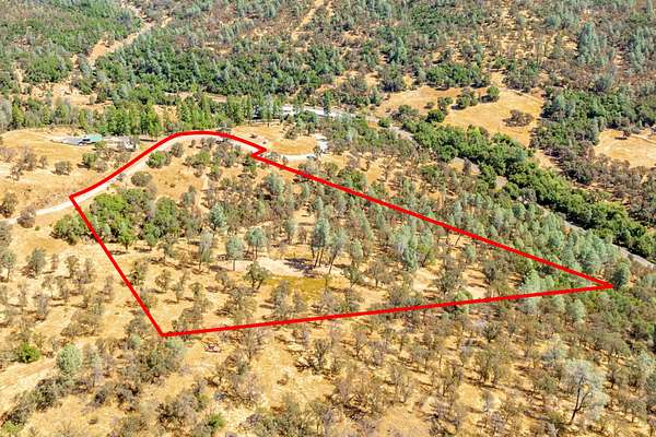
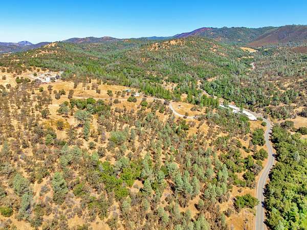
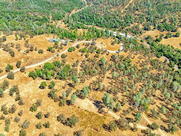
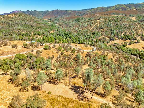
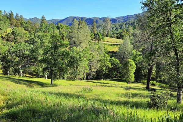
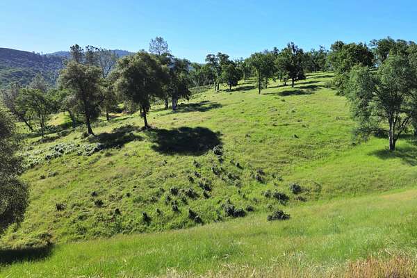
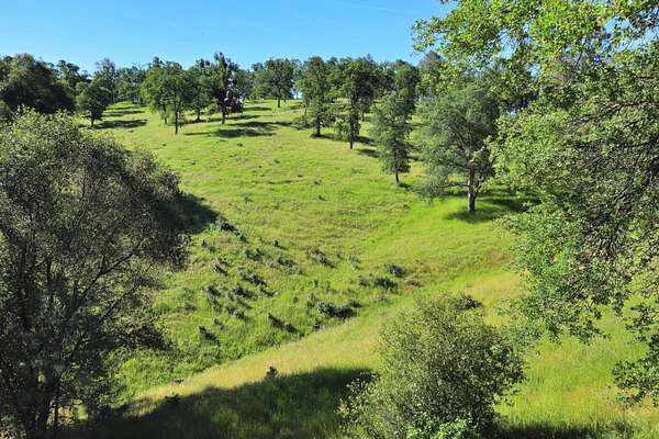
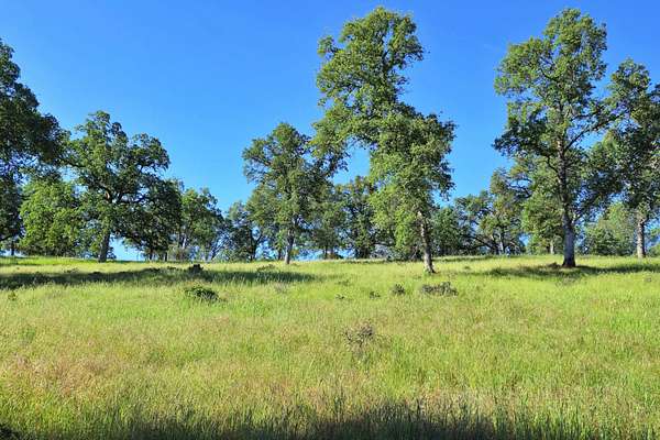
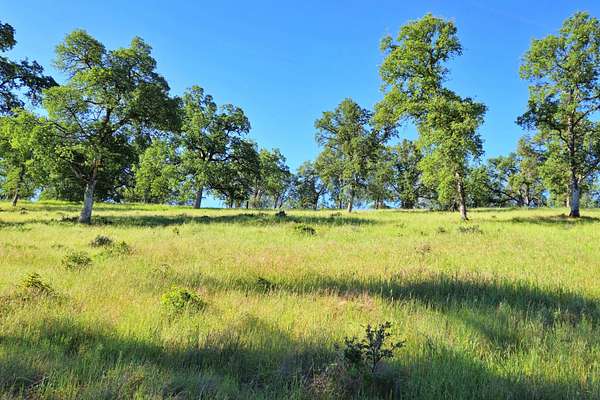
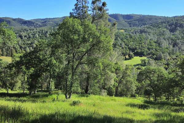
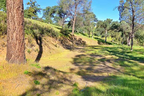
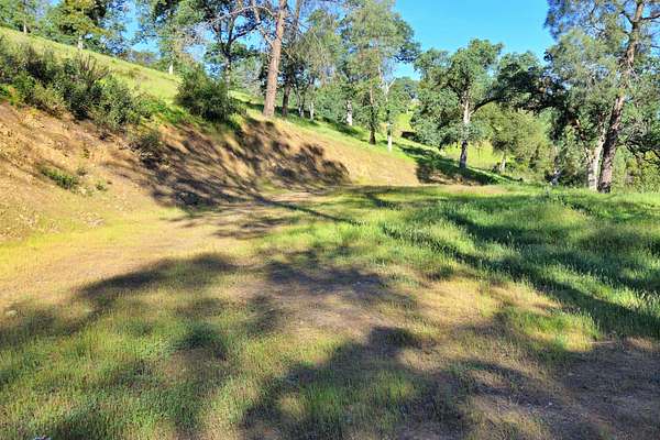
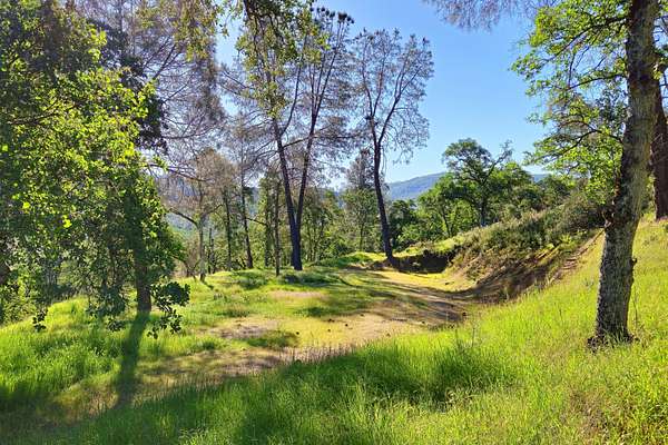
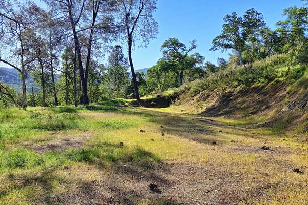
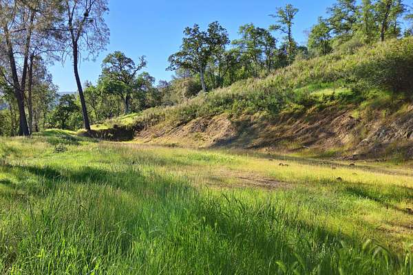
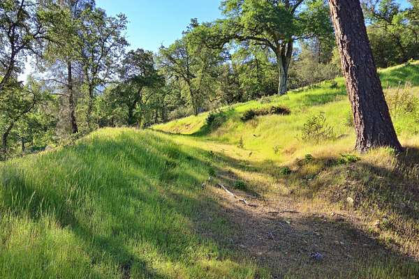
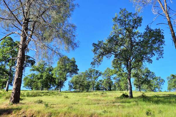
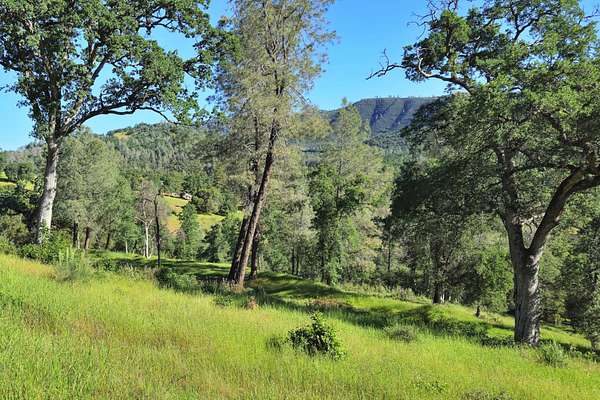
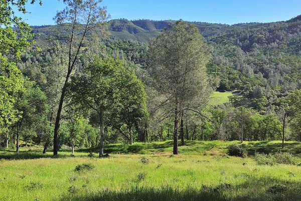
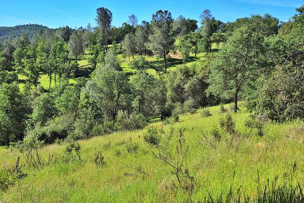
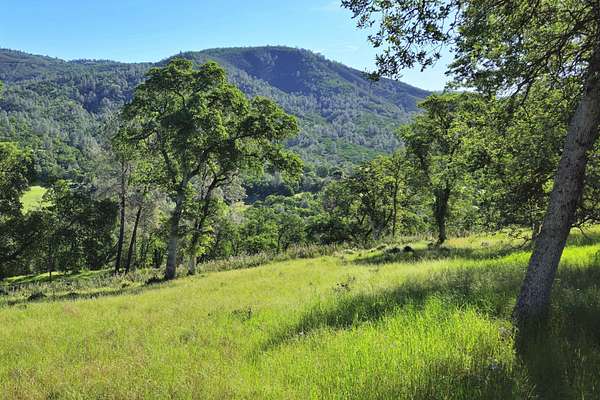
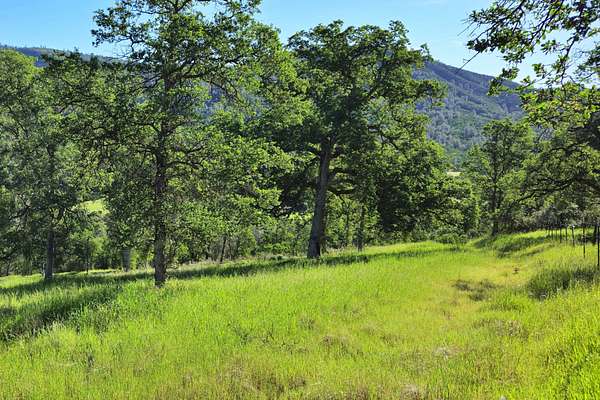
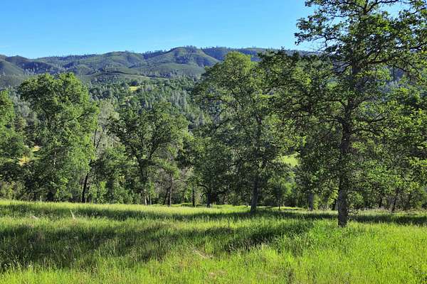
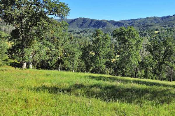
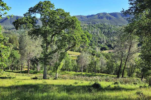
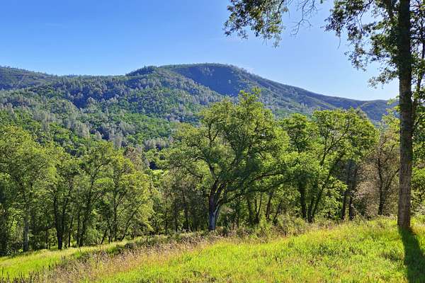
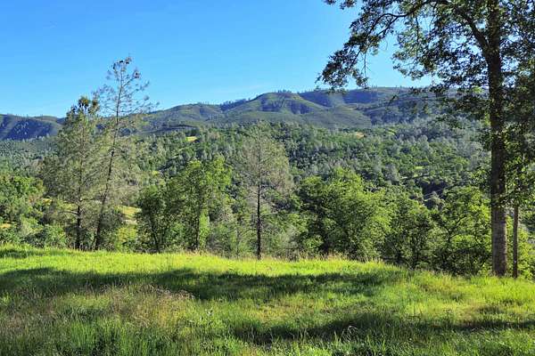
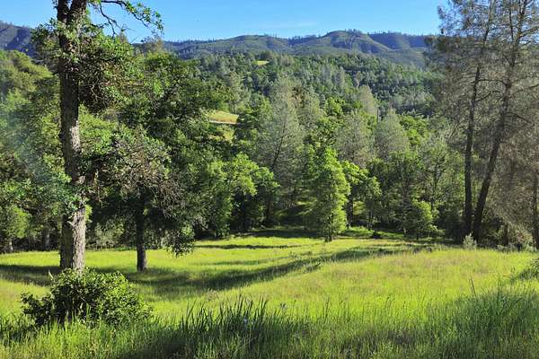
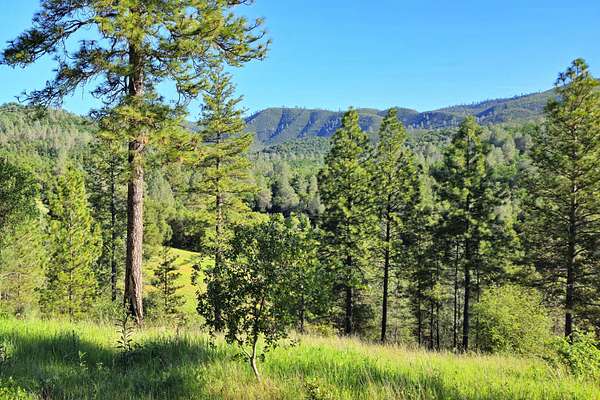
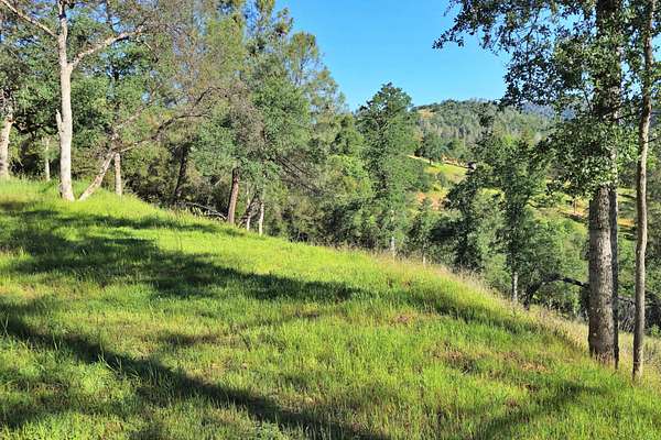
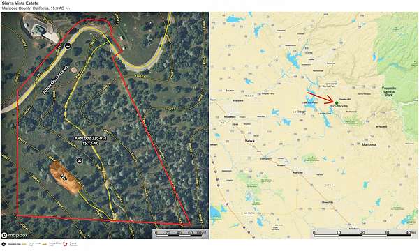
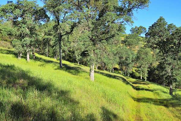
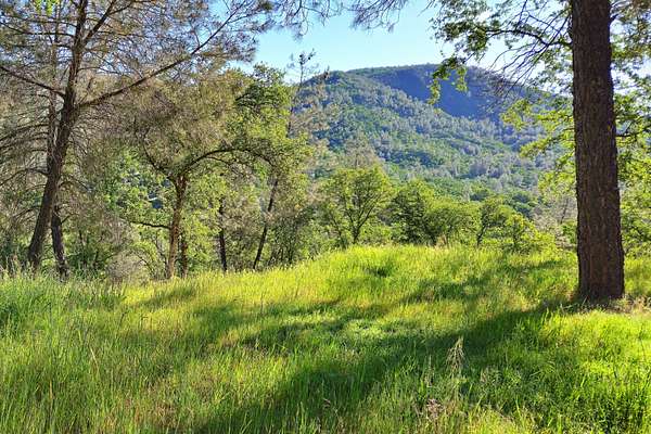
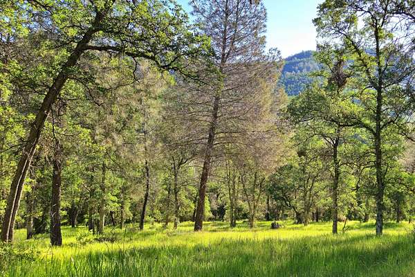
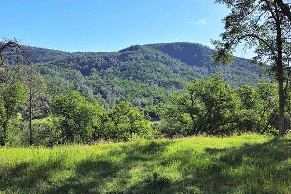
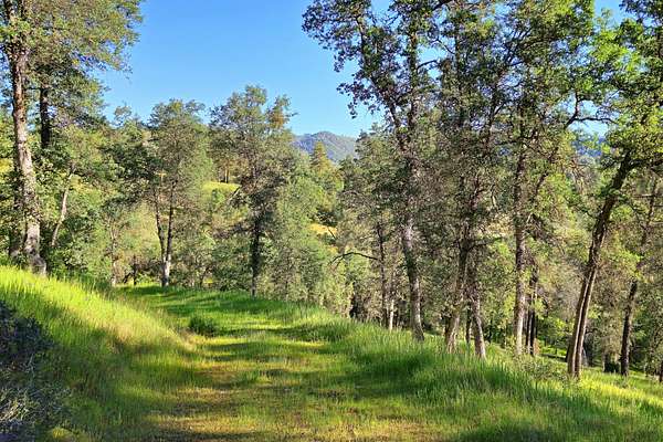
The Sierra Vista Estate is a 15.13-acre property in Coulterville in Historic Mariposa County. Located 1.7-miles northeast of town, this property includes great access, an existing building pad and a variety of possible uses, all with spectacular views of the foothills and Sierra. Located in a private area, this quiet property is centrally located along the John Muir Trail route with good proximity to resources and many recreational opportunities.
Land
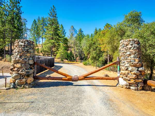
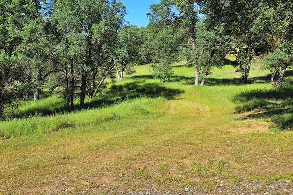
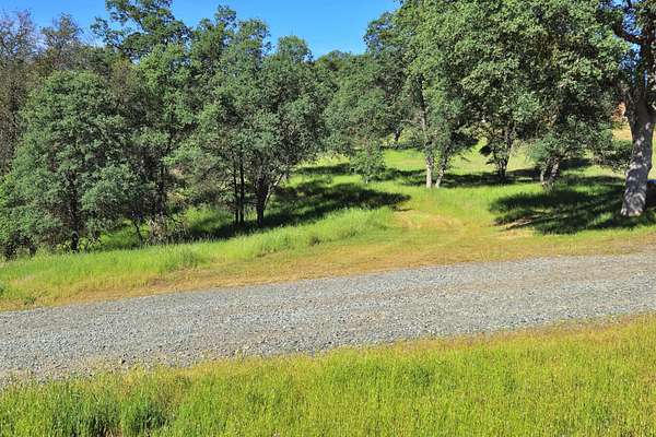
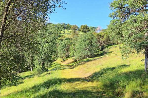
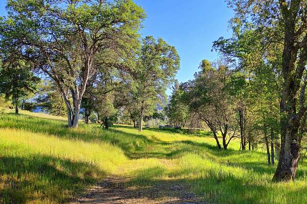
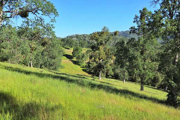
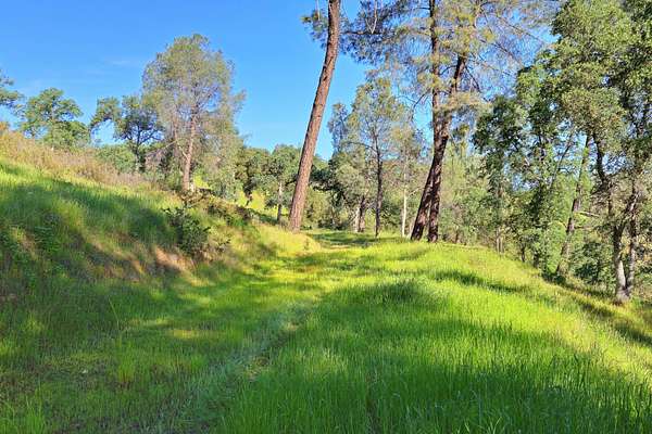
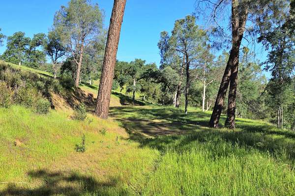
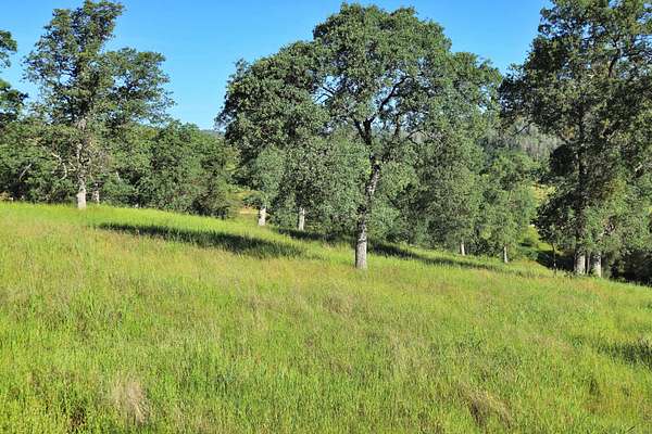
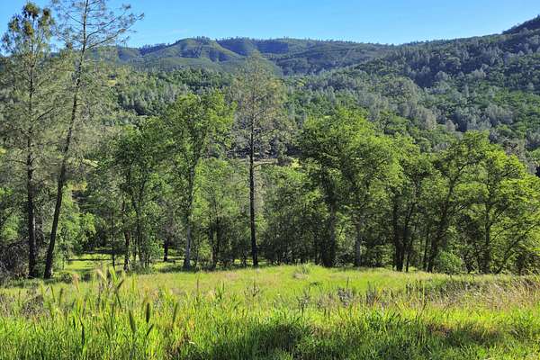
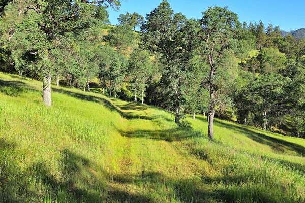
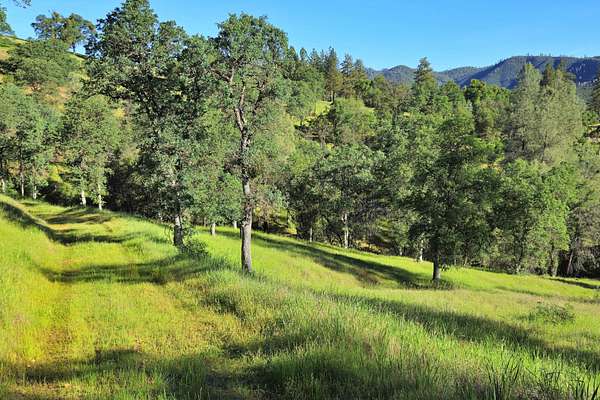
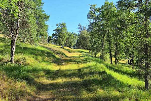
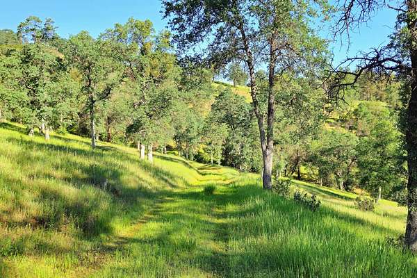
The elevation of the land is approximately 2,000’ and has convenient, well-maintained access along Boneyard Creek Road. The property is a single parcel, accessed by the shared, gated private driveway. APN: 002-230-014, 15.13-acres. The land is gently sloped and includes oak and other native tree cover, with quality habitat for livestock and area wildlife. With favorable zoning (MHZ – Mountain Home Zone), this property has the potential to be subdivided into three 5-acre parcels. The property is not currently enrolled in the Williamson Act. The adjacent parcel with home is also available; contact listing agent for more information.
NOTE: Property Video is for this listing (15.13-acres) AND the adjacent parcel property listing called “Sierra Vista Retreat” (Home + 6.4-acres). Both parcels can be purchased individually or together. Contact listing agent for more information.
Legal description, acreages, improvements, easements, property markers/monuments and other items to be verified by title and/or survey. Fences, if any, are “convenience fences” and do not indicate property boundaries. Maps are for illustrative purposes only and do not indicate or verify property boundaries or other improvements.
Improvements
Well-maintained access along Boneyard Creek Road, including an internal roadway to an existing building pad. A drainage culvert has been installed along the internal roadway for water diversion during the rainy season.
Recreation
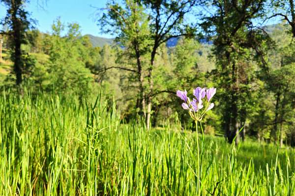
Outdoor activity opportunities in the region include hiking, hunting, fishing, off-road, biking, wildlife viewing, horseback riding and more. Other activities are available in the surrounding hills, mountains, lakes, rivers and streams of the Sierra Nevada. Yosemite, one of the most unique and picturesque National Parks in the US, is about a 30-minute drive, with snow skiing at Dodge Ridge east of Sonora. Horseshoe Bend Recreation Area at Lake McClure is a short 10-minute drive and Moccasin Point Marina at Don Pedro Reservoir is only 20-minutes away, both offering boating, water-sports and fishing. The nearby Tuolumne and Merced Rivers and streams flow down from Yosemite and the Sierras, providing excellent fly-fishing, as well the Stanislaus and Tuolumne Rivers. The West’s best lakes, rivers and streams of the foothills and Sierra surround the area, with the stunning scenery of the Gold Country, Yosemite and Sonora Pass.
Agriculture
The property is well suited for horses and livestock grazing with additional ag opportunities, including outbuildings and other infrastructure possibilities.
Water/Mineral Rights & Natural Resources
See Title
Region & Climate
Coulterville offers year-round residents and visitors desirable climate and weather. Yosemite travelers can opt to take Highway 132, aka the Historic John Muir Trail, through Coulterville and along a scenic, laid back route to the Sierra wonderland, or travel the nearby CA-120 entrance leading you through the charming historic town of Groveland and into a sportspersons’ paradise. The region has a rich history in the gold mining era and continues to provide a “Gold Country” feel in the surrounding nearby communities. The Mother Lode is a narrow belt of land in east-central California ranging in elevation between 700 and 3,000 feet. Called La Veta Madre (The Mother Vein) by Mexican miners, it runs along the western slope of the Sierra Nevada for about 250 miles between Mariposa and Sierra City and encompasses some of the most beautiful scenery in the state. From gently rolling, chaparral-covered foothills, alive with wildflowers in the spring and lion-colored grasses in summer, to slender river gorges and wooded valleys, the scenery offers pure visual delights.
History
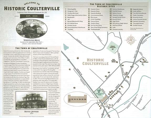
Coulterville is an authentic California gold rush town that was “too tough to die”. During its heyday, it was a major gold mining and supply center. Coulterville remains filled with historic buildings and memories of the “’49ers” and has been designated the California State Historical Landmark No. 332. Coulterville also serves as the base point of the John Muir Highway. George and Margaret Coulter traveled by covered wagon from Pennsylvania to California in 1849. Learning that the large number of placer miners seeking their fortunes in the three local creeks had to travel 30 miles over rough trails to get supplies, Coulter purchased a large supply of merchandise and opened business in a large blue canvas tent over which he conspicuously flew the American flag. The tent soon became a landmark to the nearly two thousand miners in the area and they called the place Banderita or “Little Flag.” In 1852 the discovery of gold caused the community to grow rapidly. On March 5, 1872, the name of the town was changed to Coulterville to honor its founder. The lore of gold drew miners from around the world. The Sun Sun Wo Co. Store, built of adobe in 1851, is all that remains of that area of town. Boasting to have had the “crookedest railroad in the world,” the original “Whistling Billy” locomotive now stands under the local hangman’s tree next to the museum. Across the street stands the Jeffery Hotel, whose 30” thick walls, made of rock and clay binder, date back to 1851. The connecting Magnolia Room is an authentic early day saloon. In its heyday, there were twenty-five saloons and 10 hotels scattered around town. In the late 1800’s, Coulterville became a popular stopover for Yosemite bound tourists. The first paved route into Yosemite National Park ran through Coulterville, bringing the horseless carriage. This route, via Coulterville (County Road 132), is still one of the shortest and most scenic ways to travel to Yosemite National Park.
Source: Excerpt Nat Geo, Sierra Nevada Geotourism
Location
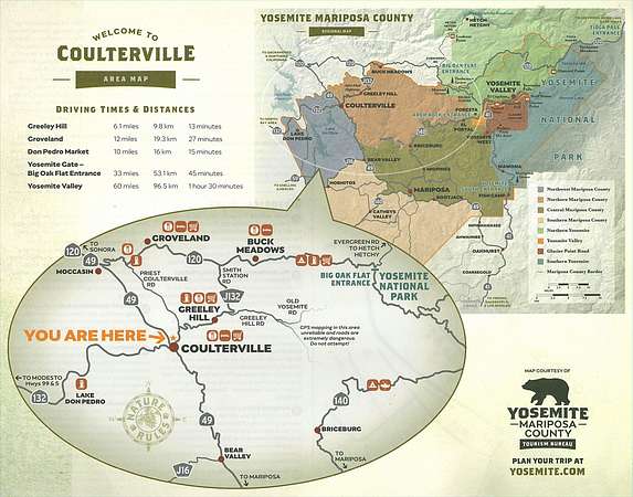
The property is 1.7-miles to Coulterville, which is at the intersection of CA-132 (Greeley Hill Road) and CA-49 (The Golden Chain Highway); 13-miles from Groveland and a 30-min drive from Jamestown and Sonora; 21-miles from La Grange to the west with Oakdale under an hour away; the Sacramento International Airport is just over a 2-hr drive to the northwest. Shopping, entertainment and ranch / home resources and supplies are available in several nearby communities. The Mariposa County Coulterville fire company is located in downtown Coulterville and the nearby Cal Fire station is 2.8-miles from the property.
Location
- Street address
- Boneyard Creek Rd
- County
- Mariposa County
- Zip code
- 95311
- Elevation
- 1,950 feet
Directions
FROM OAKDALE: Travel east on CA-120 for approx. 36.8-miles until CA-49 splits off to the right (south) at Mocassin. Travel approx. 10.5-miles south on CA-49 until Coulterville. Turn left at the CA-49/CA-132 (Greeley Hill Road) junction and travel east for 1.4-miles to Boneyard Creek Road. Turn left at Boneyard Creek Road and travel 0.3-miles until the property.
FROM SONORA: Travel south on CA-49 for approx. 6.5-miles until the CA-108/CA-49 split. Turn left onto CA-49 and travel approximately 11.8-miles until CA-49 splits off to the right (south) at Moccasin. Travel approx. 10.5-miles south on CA-49 until Coulterville. Turn left at the CA-49/CA-132 (Greeley Hill Road) junction and travel east for 1.4-miles to Boneyard Creek Road. Turn left at Boneyard Creek Road and travel 0.3-miles until the property.
FROM MARIPOSA: Travel north on CA-49 for approx. 26-miles until Coulterville. Turn right at the CA-49/CA-132 (Greeley Hill Road) junction and travel east for 1.4-miles to Boneyard Creek Road. Turn left at Boneyard Creek Road and travel 0.3-miles until the property.
Property details
- Acreage
- 15.13 acres
- Posted
Resources
Listing history
| Date | Event | Price | Change | Source |
|---|---|---|---|---|
| June 25, 2026 | Relisted | $145,000 | — | Listing agent |
| June 19, 2026 | Listing removed | $145,000 | — | Listing agent |
| Apr 16, 2026 | New listing | $145,000 | — | Listing agent |