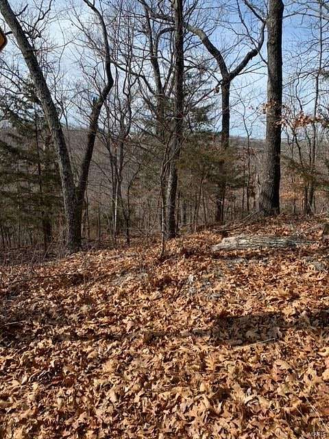
10.8 Acres of Land for Sale in High Ridge, Missouri
Davis Dr, High Ridge, MO 63049
Images
Map

$45,000
10.83 acres
Active sale$20k dropEst $513/mo
BEAUTIFUL, COUNTRY PROPERTY TO BUILD YOUR DREAM HOME. ONE ENTRANCE OFF OF DAVIS DR AND ONE ENTRANCE OFF OF WHIPPORWILL. NOT FAR FROM SHOPPING AND INTERSTATE ACCESS.
Directions
FROM HWY 30-HIGH RIDGE BLVD TO ANTIRE RD. LEFT ON LITTLE ANTIRE RD. RT ON JIM WEBER RD. RT ON DAVIS DR. SLIGHT RT ON SPAVALE. FROM EUREKA- MO-109S. LEFT ON STATE HWY W. LEFT ON TWIN RIVERS RD. LEFT ON JIM WEBER. RT ON DAVIS DR. SLIGHT RT ON SPAVALE.
Property details
- County
- Jefferson County
- Community
- Twin River Estates
- School District
- Northwest R-I
- Zoning
- RESIDENTIAL
- Elevation
- 735 feet
- MLS Number
- MARIS 19033486
- Date Listed
Parcels
- 03-2.0-09.0-0-000-012.02
Property taxes
- 2018
- $646
Expenses
- Home Owner Assessments Fee
- $450 annually
Nearby schools
| Name | Level | District | Description |
|---|---|---|---|
| High Ridge Elem. | Elementary | Northwest R-I | — |
| Northwest Valley School | Middle | Northwest R-I | — |
| Northwest High | High | Northwest R-I | — |
Listing history
| Date | Event | Price | Change | Source |
|---|---|---|---|---|
| Nov 10, 2023 | Price decrease | $45,000 | $19,980 -30.7% | MARIS |
| Nov 21, 2022 | Price decrease | $64,980 | $21,660 -25% | MARIS |
| May 20, 2021 | Price decrease | $86,640 | $10,830 -11.1% | MARIS |
| Feb 23, 2021 | Price decrease | $97,470 | $10,830 -10% | MARIS |
| May 8, 2020 | Price decrease | $108,300 | $21,660 -16.7% | MARIS |
| Oct 14, 2019 | New listing | $129,960 | — | MARIS |
Payment calculator
Contact listing agent
By submitting, you agree to the terms of use, privacy policy, and to receive communications.