Residential Land for Sale in Anderson, California
Shady Ln Anderson, CA 96007
Images
Map
Street


$650,000
2.35 acres
Active sale agoEst $5,094/mo
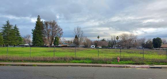
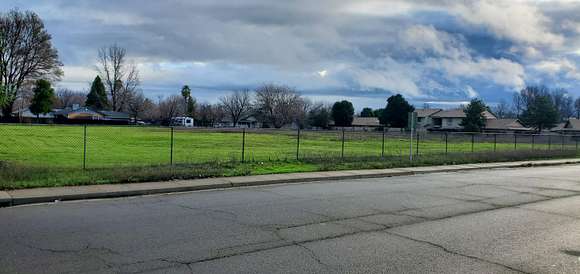
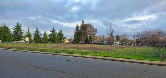
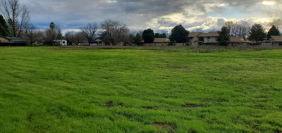
Prime location! 2.35 acre parcel of level land zoned Anderson R-3 High Density Residential. Buyer to confirm with City of Anderson, Planning and Public Works Departments as to future use of the parcel, number of units and cost of permits for development of this parcel. Sidewalk, curb, gutter and fire hydrant fronting on Shady Lane. Parcel Map and Conditions of Approval at Documents.
Directions
Balls Ferry Rd. to Shady Lane. Parcel fronts on Shady Lane just past the Anderson Seventh-day Adventist Church.
Location
- Street Address
- Shady Ln
- County
- Shasta County
- Elevation
- 413 feet
Property details
- Zoning
- Anderson R-3 High Density Residential
- MLS Number
- SHASTA 24-518
- Date Posted
Parcels
- 052-340-067
Listing history
| Date | Event | Price | Change | Source |
|---|---|---|---|---|
| Feb 3, 2024 | New listing | $650,000 | — | SHASTA |
Payment calculator

Contact listing agent
By submitting, you agree to the terms of use, privacy policy, and to receive communications.