

Recreational & Residential Land for Sale in Tonasket, Washington
State Route 20, Tonasket, WA 98855
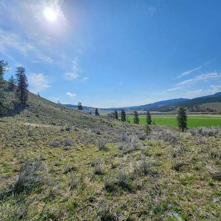
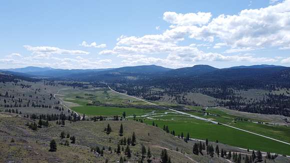
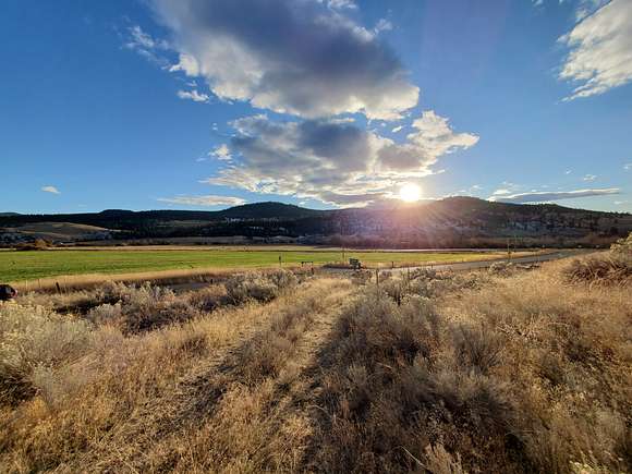
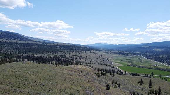
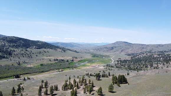
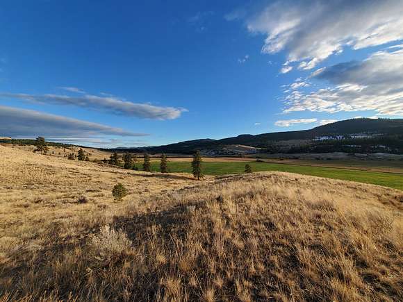
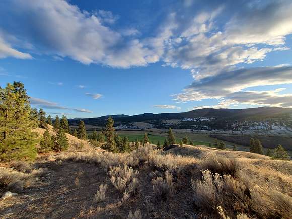
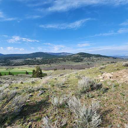
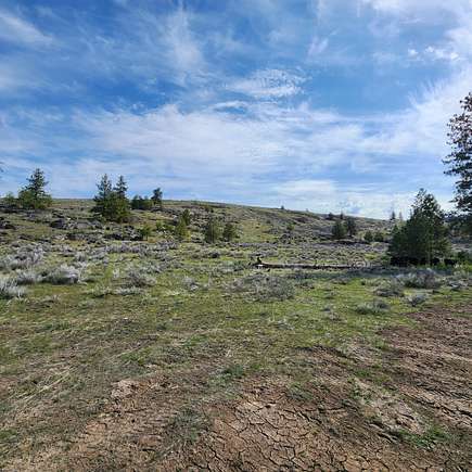
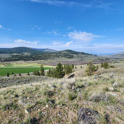
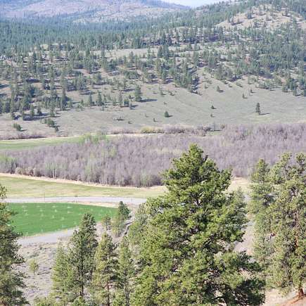
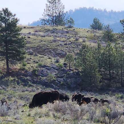
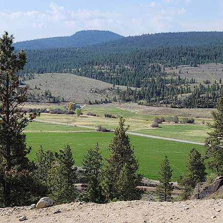
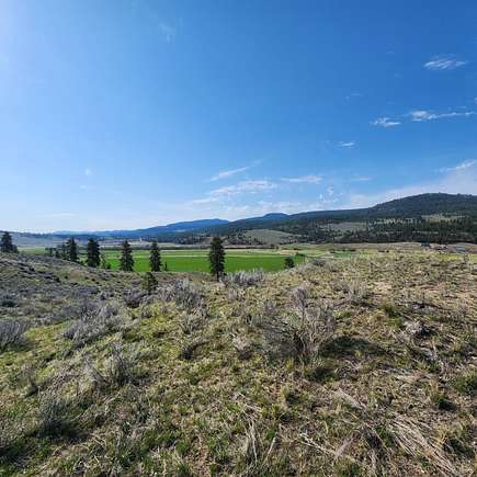
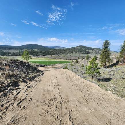
Valley Views. The property faces the South, so the snow melts off early in spring to allow easy access directly off SR 20. Abundant wildlife Mule Deer & Whitetail, Turkeys to name a few. Close to the quaint town of Tonasket with shopping and restaurants. The town of Omak is 45 minutes from where you can find Home Depot and Walmart, Enjoy all four seasons in the Okanogan with 300 days of sunshine
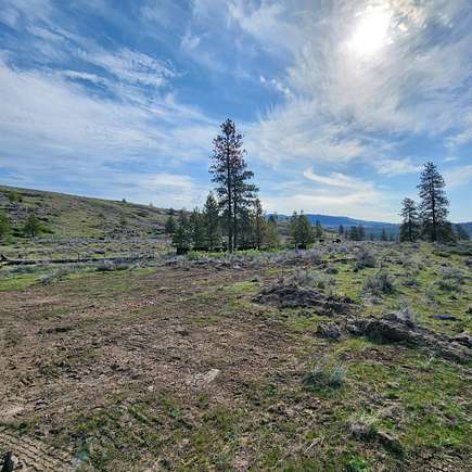
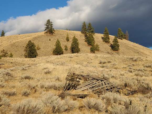
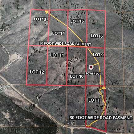
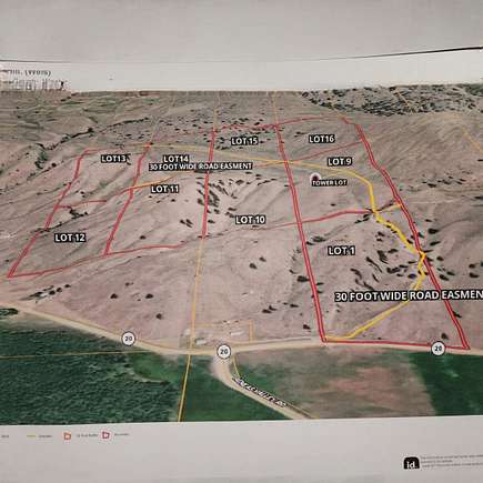
Improvements
Power is installed in main easement road for easy access
Recreation
Summer time recreation. The cool mornings and warm sunny afternoons are perfect for hiking, biking and horseback riding along scenic trails. Check out our new page for Urban and Walking Trails to find shorter walks and hikes close to town, perfect for a midday adventure!
Okanogan County in North-Central Washington State has the best family vacations! Scenic byways, tours, hikes, and family adventures await you in every corner of Okanogan Country: from the Northern Okanogan Region, to the Methow Valley, across the Columbia River Basin, and into the Heart of the Okanogan. An affordable family vacation with endless outdoor adventure awaits you in our breath taking snow-capped North Cascade Mountains and gorgeous winding river basins. Experience a Washington State getaway with horse riding, miniature golf, swimming, fresh wholesome food, blue skies, and starry nights – a vacation that will keep you coming back for more!
Winter time recreation. The fun doesn’t just end in Okanogan Country once summer is over…
There is plenty of fun for all to have all year round in Okanogan Country. Want to take your kids ice skating? Winthrop Ice & Sports Rink has you covered! This outdoor facility is within walking distance from downtown and the ice is groomed daily! Nordic skiing more your speed? The Methow Valley is home to the largest nordic ski trail system in the nation as well as home to several olympic ski champions. A NEW opportunity that is fun for all is luge sledding! Ride a rented sled at the Loup Loup Ski Bowl down more than 12 km of groomed trails! There is plenty of fun to have for all members of the family and some of the best winter recreation in all of Washington!
With more than 300 days of sunshine every yearand 3 million acres of public land, OkanoganCountry has everything for everyone. With accessto the Cascade Mountains, North CascadesNational Park, the Okanogan Highlands, theColumbia River, and dozens of historic sites andcharming small towns, we’re also a portal toCanada and to some of the most rugged andremote places on the planet. Our places, people,and experiences are authentic. You can get offthe grid, unplug, and plug in to nature at everyturn—immersing yourself in the outdoors with adiversity of wildlife, from hundreds of species ofbirds to moose, deer, black bear, and many othercreatures. With over 120 miles of groomed,interconnected trails for hikers, fat-tire bikers,snowshoers, and backcountry skiers, we offerthe largest ski-trail system in North America,along with hundreds more miles for backroadadventures. From peaceful past-times to extremeadventures, you can interact with friendly peopleunder wide open blue skies or enjoy the a starrynight sky that stretches to the horizon. Ourfestivals, rodeos, and small town events offerenjoyment year-round, and with agritourism anddiverse cultural events and activities, you canexperience the true West—like it once was, longago, and like it is today, in living, breathing color
Okanogan Highlands has historically been a significant source of mineral production. While the primary target has been gold, other ore deposits have been mined as well.
History
Okanogan is the county seat of Okanogan County in north-central Washington in the productive orchard lands of the Okanogan River Valley. This town site, on the west bank of the Okanogan River, was first settled in 1888 and was called Alma. In 1905, the town’s name was changed to Pogue, in honor of a prominent citizen. In 1907 the town voted overwhelmingly to change the name to Okanogan, in order to better reflect its place on the Okanogan River and its proximity to the fledgling Okanogan Irrigation Project. Later in 1907, the town voted nearly unanimously to incorporate. The new town boomed along with the region’s apple orchards and timber industry. In 1914, the Great Northern railroad arrived and Okanogan succeeded in a spirited campaign to wrest the county seat from Conconully. By 1930, Okanogan was overtaken in population by Omak, its neighbor five miles to the northeast. As of 2010, Okanogan’s population was estimated at 2,500, a little more than half the size of Omak. Yet Okanogan remains the governmental hub of Okanogan County, and the original 1915 county courthouse still presides over the city.
Early Days
The site of Okanogan was used for thousands of years as a camping ground and fishing area by the Southern Okanogan Tribe, also known as the Sinkaietk or Uknaqinx, as well as by several other tribes of the mid-Columbia. Steelhead and salmon runs were plentiful on the Okanogan River.
The Okanogan River was also well known to fur traders and other early non-Indian explorers in the early 1800s. 1n 1833 the famed botanist David Douglas (1799-1834) camped at the mouth of a creek that was probably Salmon Creek, where the town is today.
Farms, Orchards, and a Town
However, by around 1900, the mining fever was cooling off and settlers began turning their eye to another kind of gold — agricultural bottomlands. People began to realize that, with the addition of irrigation water, the Okanogan Valley could be rich orchard land and farmland. In 1905, the Okanogan Irrigation Project was approved by the U.S. Department of the Interior, making it the first U.S. Reclamation Service project in the state. Contracts were let in 1906. Pioneer entrepreneurs began platting future town sites to serve what they envisioned as a bustling agricultural valley
Location
The property is located 15 Minuets West of the town of Tonasket and 20 minuets West of the town of Republic Washington . The property is situated at the very beginning of the historic Aeneas valley.
Location
- Street address
- State Route 20
- County
- Okanogan County
- Zip code
- 98855
- Elevation
- 2,600 feet
Directions
From Tonasket, Washington, zip code 98855. Go east on SR 20, 24.3 miles to the property on the North side of SR 20 & the intersection of Aeneas Valley Rd. New gate, look for the Hayden Outdoors sign
Property details
- Acreage
- 20 acres
- Posted
Resources
Listing history
| Date | Event | Price | Change | Source |
|---|---|---|---|---|
| Jan 5, 2026 | Relisted | $59,000 | — | Listing agent |
| Jan 2, 2026 | Listing removed | $59,000 | — | Listing agent |
| Jan 12, 2025 | Relisted | $59,000 | — | Listing agent |
| Jan 2, 2025 | Listing removed | $59,000 | — | Listing agent |
| June 28, 2024 | Relisted | $59,000 | — | Listing agent |
| June 10, 2024 | Listing removed | $59,000 | — | Listing agent |
| July 31, 2023 | Price drop | $59,000 | $40,000 -40.4% | Listing agent |
| June 20, 2023 | New listing | $99,000 | — | Listing agent |