Recreational Land for Sale in Leivasy, West Virginia
Sugar Run Rd Leivasy, WV 26679
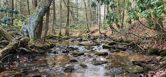
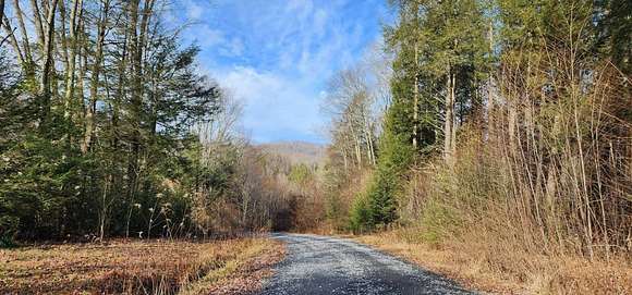

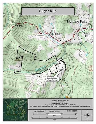

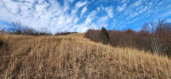
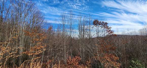


Sugar Run is a 77-acre +/- multi-use property located in the heart of the New River Gorge recreational mecca, giving access to unlimited recreational opportunities. HIGHLIGHTS *Contiguous 77 +/- acre multi-use parcel *Superb recreational opportunities in the heart of the New River Gorge water sports mecca *One million-acre Monongahela National Forest nearby *Proximity to 5 rivers and 3 lakes. These include the New River, Gauley River, Cherry River, Cranberry River, and Greenbrier River, and Summersville Lake, Summit Lake and Bluestone Lake *Plenty of forest trails that offer excellent access to a large portion of the forest *Two mountain springs on the property that could be developed *Exceptional rock outcrops suitable for climbing *Perfect for shooting sports, ATV riding, horseback riding, hiking, camping, hunting and nature viewing *City of Summersville is a 35-minute drive *35 minutes to Summersville Airport *High percentage of commercially - operable ground supporting forestry, recreation and potential for numerous future cabin sites *Elevations range from 2381 ft. to 2848 ft. +/- *Potential conservation value *Low taxes, low population density, little or no light pollution *The rivers and lakes are ideal for swimming, canoeing, fishing, kayaking, tubing, snorkeling, paddle boarding and windsurfing *Forest is a steady producer of life-giving Oxygen and silently works to sequester carbon *Over 40 years of professional forest and wildlife management *Jet airports in Beckley, Charleston and Lewisburg are a 90 minute drive *Potential for leasing carbon credits DESCRIPTION Sugar Run, with 77 acres+/-, shares the regional area with several public lands' giving access to over one million acres of managed wilderness and parks. Area National and State recreational properties include: 3,000-acre Summersville Lake 80,000-acre New River Gorge National Park and Preserve One Million Acre Monongahela National Forest 25-mile-long Gauley River National Recreation Area 47,815-acre Cranberry Wilderness 11 mile long Cherry River LOCATION Google Coordinates: 38.138623?(N), -80.725527?(W) Address: Sugar Run Road, Leivasy, WV 26679. No 911 address is assigned to property without structures. Elevation Range: 2381 ft. to 2848 ft. +/- WATER Sugar Branch, a blue line stream, runs through the property for over 1/2 mile. It should have regular water flow, especially during rain events and snow melt. Two mountain springs are located on the property which could be developed. MINERAL RESOURCES Various mineral rights have been either reserved or conveyed by prior deeds of record, and the property is being sold SURFACE ONLY. BOUNDARIES AND SURVEY The property will be surveyed for the sale deed to separate it from a large tract of land. The property is being sold by the boundary and not by the acre. UTILITIES Water: Public water nearby or a water well could be drilled (spring water has also been discovered) Sewer: Septic systems would need to be installed Electricity: Available nearby Telephone: Available nearby Internet: May be available through cable, satellite or cell phone Cellphone Coverage: Excellent with 5G ACCESS/FRONTAGE The property is accessed from Hominy Creek Road Rt. 13/4 by Sugar Run Road, which runs through the property for about 1/2 mile. ZONING Nicholas County has no zoning regulations in effect other than that which is enacted and enforced within the city limits of Summersville and Richwood. All prospective purchasers are encouraged to contact the Nicholas County Health Department and the Nicholas County Flood Zone Administrator regarding installation of septic systems, water wells, and flood insurance requirements.
Directions
From Leivasy, WV: 2.5 miles +/- (10 minutes +/-) From the Leivasy Post Office, travel Rt. 20 South for 4/10 mile; turn right onto Hominy Falls Road; travel 1.5 miles; turn sharp left onto Hominy Creek Road; travel 4/10 mile; turn right onto Sugar Run Road; travel 2/10 mile to inside the main part of the property.
Property details
- County
- Nicholas County
- Elevation
- 2,379 feet
- MLS Number
- MyStateMLS 11280140
- Date Posted
Detailed attributes
Listing
- Type
- Vacant Land
Lot
- Views
- Water
Listing history
| Date | Event | Price | Change | Source |
|---|---|---|---|---|
| May 17, 2024 | New listing | $125,000 | — | MyStateMLS |